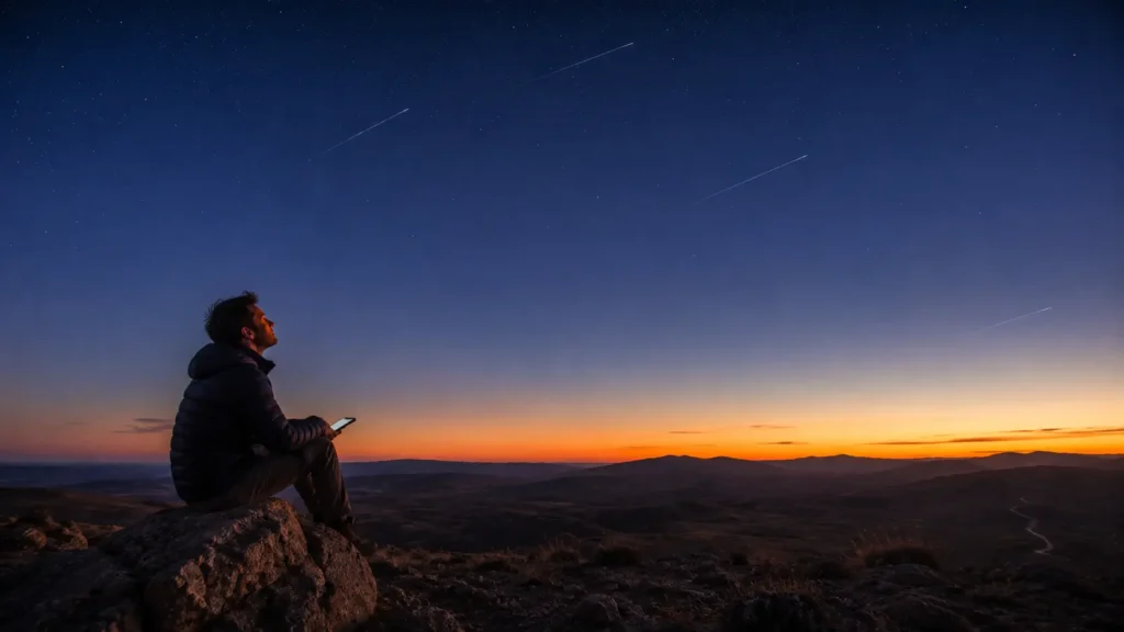
You are standing on a ridge in the Wyoming backcountry. No phone signal. No cell tower within 200 miles. The nearest Wi-Fi is in a town you left three hours ago. You pull out your phone, open your mapping app, and a blue dot appears precise, confident, accurate to within a few metres.
Most people assume GPS needs an internet connection. It does not. It does not need a cell tower. It does not need Wi-Fi. It does not need anything on the ground at all.
What it needs is the sky. And the sky in the middle of nowhere is the one thing you always have.
What GPS Actually Is
GPS the Global Positioning System is a one-way radio conversation between satellites and your device. The satellites talk. Your receiver listens. Nothing is transmitted from your phone upward. The satellites do not know you exist.
The system was built by the US military, declared operational in 1995, and made fully accurate for civilians in 2000 when the deliberate scrambling of civilian signals called Selective Availability was switched off permanently. Before that date, civilian GPS was accurate to hundreds of metres. Overnight, it became ten times more precise.
Today, the US GPS constellation comprises 31 operational satellites orbiting at approximately 20,200 kilometres above Earth, completing two full orbits every day. At any point on Earth’s surface, between four and twelve satellites are above the horizon and visible to a receiver. Your phone uses whichever ones it can see.
The Speed of Light Is Both the Tool and the Problem
Here is the core mechanism: each GPS satellite continuously broadcasts two pieces of information its exact position in space and the precise time the signal was sent.
Your receiver catches that signal, notes the arrival time, and multiplies the time difference by the speed of light to calculate the distance between you and that satellite.
Light travels at 299,792,458 metres per second. A GPS signal covers the 20,200-kilometre journey from satellite to receiver in roughly 67 milliseconds. Because distance is calculated from such a tiny travel time, an error of just one microsecond in timing corresponds to a positional error of 300 metres.
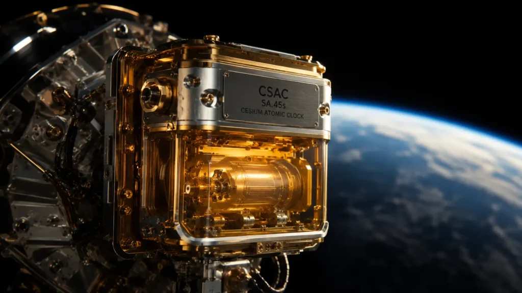
This is why GPS cannot work with cheap clocks. Each satellite carries atomic clocks caesium or rubidium accurate to about 4 nanoseconds per day. Ground control continuously monitors and corrects each satellite’s clock to within 20 nanoseconds of master GPS time.
Your phone, however, has a cheap crystal oscillator fine for telling the time, catastrophically inadequate for GPS geometry. It can drift by milliseconds per day, which at GPS precision translates to hundreds of kilometres of positional error.
This is why GPS requires a fourth satellite.
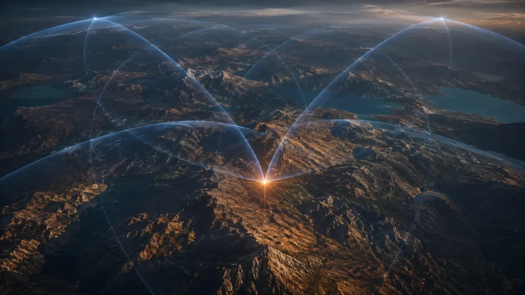
Why Four Satellites Not Three
In three dimensions, three satellite signals define the intersection of three spheres, narrowing your position to a single point. But the cheap clock in your receiver introduces an unknown error into every distance calculation. The unknowns become: your latitude, your longitude, your altitude, and your clock error.
Four satellites provide four equations to solve four unknowns simultaneously. The fourth satellite does not improve geometric precision it corrects your device’s clock, aligning it with GPS atomic time as part of the position calculation itself.
This is an elegant engineering shortcut. Instead of putting a $50,000 atomic clock in every phone, the system solves for clock error using one extra satellite. Your phone’s cheap oscillator is corrected in real time, every time, to within nanoseconds.
Einstein’s Contribution to Your Navigation
Einstein’s theories of relativity are not abstract physics here. They are active engineering requirements and without correcting for them, GPS would be useless within two minutes.
Two effects pull in opposite directions. Special relativity says faster-moving clocks tick slower. GPS satellites move at roughly 14,000 km/h, causing their clocks to lag ground clocks by about 7 microseconds per day. General relativity says clocks in weaker gravity tick faster. At 20,200 kilometres altitude, weaker gravity makes satellite clocks gain about 45 microseconds per day.
Net effect: satellite clocks gain roughly 38 microseconds per day relative to Earth. Uncorrected, GPS errors would accumulate at 10 kilometres per day useless for navigation within minutes.
Engineers solved this before launch: satellite clocks are manufactured to tick slightly slow at 10.22999999543 MHz instead of 10.23 MHz so that once in orbit, relativistic effects bring them into sync with ground clocks. Receivers apply additional real-time corrections as part of every position calculation.
The GPS in your pocket works because engineers in the 1970s correctly applied theories Einstein published in 1905 and 1915 to a satellite navigation problem.
What Makes the Middle of Nowhere Actually Easier
In a city, GPS struggles with buildings, reflections, and signal blockage. In true wilderness, those problems disappear.
Atmospheric delay remains a constant GPS signals slow slightly passing through the ionosphere and troposphere, an effect receivers model and correct for. What matters most is Dilution of Precision (DOP) the geometric spread of visible satellites across the sky. Satellites clustered together give poor geometry. Satellites spread evenly give strong geometry and better accuracy.
In open wilderness with a clear, unobstructed sky, DOP is typically excellent often better than in a city. This is why your GPS is frequently more accurate in the backcountry than on a city street, despite the total absence of ground infrastructure.
Cold temperatures are the main wilderness-specific challenge they push your phone’s crystal oscillator further from its calibrated frequency, slightly lengthening the time needed for initial signal lock in deep cold.
What Your Phone Adds on Top of Raw GPS
A-GPS (Assisted GPS) downloads satellite almanac data from the internet before you lose signal, letting your receiver acquire position in seconds instead of up to 12.5 minutes from a cold start. Without a recent refresh, that cached data ages over several days in deep wilderness.
GNSS — the combination of GPS with Russia’s GLONASS, Europe’s Galileo, and China’s BeiDou means modern phones receive signals from all four constellations simultaneously, improving geometry, speed, and redundancy.
Barometric altimeters provide altitude independently of satellites, strengthening the position solution where ridgelines might obscure part of the sky.
The Bottom Line, Out in the Field
When you stand on that Wyoming ridge, your phone is catching radio signals from satellites moving at 14,000 km/h, 20,200 kilometres above you, measuring their 67-millisecond travel times with nanosecond precision, correcting its own cheap clock using a fourth satellite, applying relativistic corrections Einstein predicted a century ago, and solving a four-variable equation to place a blue dot on a map accurate to within a few metres.
None of that required a cell tower, the internet, or any ground infrastructure between the satellite and your hand.
The sky is the infrastructure. In the middle of nowhere, that is the one thing that is always there.
📌 Read Also:
- How Undersea Internet Cables Carry 99% of Global Data
- How Google Maps Knows There’s a Traffic Jam Before Anyone Reports It
© AiwalaNews | Global Tech & Privacy Edition | April 2026